The Great Australian Bight is a very large bight (or bend in the coast that forms an open bay) on the southern edge of the Australian continent. The Great Australian Bight runs east to west in alignment with the equator and is the longest ice-free coastline running in this direction in the Southern Hemisphere.
On the Edge on a Continent
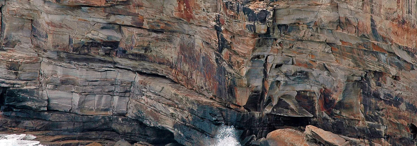
The Great Australian Bight is located approximately eighty kilometres west of Yalata and twenty kilometres east of the Nullarbor Roadhouse and is a great place to view the Southern Right Whales between June and October each year. The Marine Park is in the middle of the Great Australian Bight and the whales can be seen blowing water, tail slapping and rolling. Adult whales may be attracted to shallow areas where there are springs of fresh water on the seabed, which may help to kill parasites. View the spectacular Bunda Cliffs! A sight not to be missed!
First Nation people have always lived on the shores of The Bight. Europeans first explored it in the nineteenth century, with whalers, sealers, farmers and government surveyors entering the region following initial surveys by Matthew Flinders (1774-1814) and Edward Eyre (1815-1901). Little rain falls on the Nullarbor Plain and no major rivers flow into the Bight. Very little sediment has washed from the land onto the continental shelf. Instead the sediments on the seabed build up mainly from particles such as seashells settling out of the seawater.
Like the Southern Ocean, strong winds drive across the Great Australian Bight and the sea is usually very rough. In the summer hot, dry winds blow from the deserts of central Australia over the Bunda Cliffs, which form the northern coastline of the Bight. They help evaporate more water from the sea surface, increasing the amount of salt in the surface waters. Often the winds blow from the right direction to force cold water to well up from the bottom to the surface near the Eyre Peninsula, which forms the eastern coastline of the Bight. This brings nutrients near the surface where marine plants can grow and support food chains.
Attractions
- Southern Right Whale watching - June to October
- Bunda Cliff Viewing
Facilities
- Only one viewing platform can be found here but there are several other viewing platforms located along the coast line between the Border Village and the Nullabor Roadhouse to view the Southern Right Whales and Bunda Cliffs.
- Sealed road to the car park
- Undercover picnic area
- Public Toilets
- Water tank
- Southern Right Whale Display Information Boards
Longitude:
131.2381872
![Yalata [The Nullarbor]](/places-to-go/south-australia/eyre-peninsula/image/s/yalata-nullarbor.webp)

![Smoky Bay [The Nullarbor]](/places-to-go/south-australia/eyre-peninsula/image/s/smoky-bay-the-nullarbor.webp)
