Uluru
Latitude:
-25.344329
Longitude:
131.032510
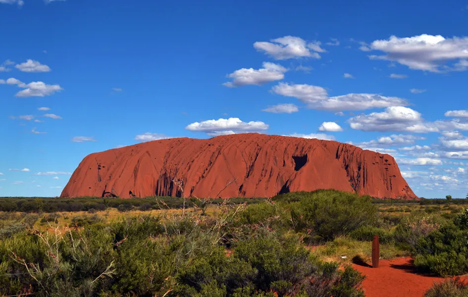
Uluru - Central Australia
Uluru (also known as Ayers Rock) is a large sandstone rock formation in the southern part of the Northern Territory in central Australia. It lies 335km south west of the nearest large town, Alice Springs, 450km by road.
Uluru is sacred to the Pitjantjatjara Anangu, the Aboriginal people of the area. The area surrounding the formation is home to many springs, waterholes, rock caves and ancient paintings. Uluru is listed as a UNESCO World Heritage Site.
Uluru is probably Australia's most recognisable natural landmark. It's a sandstone formation which stands 348m high, rising 863 m (2,831 ft) above sea level with most of its bulk lying underground, and has a total circumference of 9.4 km.
Uluru changes colour at different times of the day and year, and famous for when it glows red at dawn and sunset.
Local Aboriginal people recognise five seasons:
- Wanitjunkupai (April/May) – Cooler weather
- Wari (June/July) – Cold season bringing morning frosts
- Piriyakutu (August/September/October) – Animals breed and food plants flower
- Mai Wiyaringkupai (November/December) – The hot season when food becomes scarce
- Itjanu (January/February/March) – Sporadic storms can roll in suddenly
Latitude:
-25.344329
Longitude:
131.032510