Coral Coast

Western Australia

Payungu Country

Ningaloo / Coral Bay

Ningaloo / Coral Bay

Ningaloo Reef is a barrier reef 260km's long & protects a pure white shallow sandy lagoon of clear tropical waters, which is the home to more than 500 species of tropical fish and 220 species of coral. Ningaloo Reef is a world-class protected marine park and part of Western Australia's Coral Coast. It is also Australia's largest fringing coral reef.

Enjoy a whale watching trip viewing the majestic Humpback Whales, or some scuba or snorkelling on the reef. See amazing multi coloured fish and underwater features.

A Very BIG Fish!

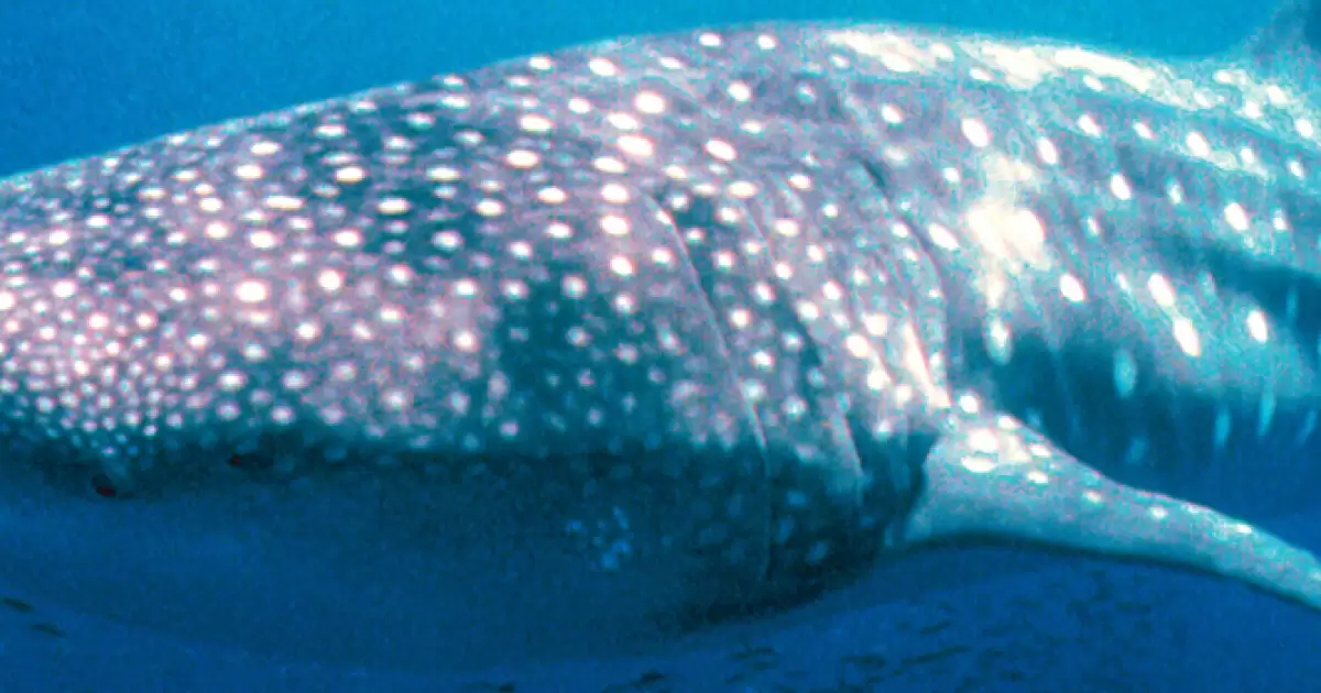
The largest fish, and the largest of the shark family in the world inhabits the Ningaloo Marine Park ... the Whale Shark - and it is a harmless plankton eater. Whale sharking (swimming with the fish) is an exhilarating experience that almost defies description. It is a daily visitor to the Ningaloo Reef every year between late March to June or July close to the reef feeding on the plankton in the nutrient rich waters. On some days up to 25 to 30 whale sharks can be seen.

Whale Sharks can reach 18 metres (60ft) but averages 12 metres (40ft) in length, and is easily identified by its huge size, wide mouth and distinctive pattern of white spots.

How to get there ...

You can arrive by air to a small airport in Exmouth called Learmonth (code LEA) which is serviced with daily flights from Perth on Skywest. It is about 100kms north of Coral Bay and a shuttle bus is available from the airport, but it must be booked in advanced ($75/person). For flight information, please contact your travel agent or check the web for Skywest. Driving is another option, you can drive private or rental vehicles. Maybe enjoying a slow social trip is more your style? Therefore you can catch the Integrity or Greyhound bus from Perth.

  • from Exmouth in the north: Exmouth is located at the northern end, and is 1270km from Perth on the Exmouth Gulf
  • from Coral Bay in the south of the North West Cape : Coral Bay marks the southern extreme of the reef.


Ningaloo Reef Map   

Latitude:

-22.68374584177516

Longitude:

113.7065274653538


02 Mar 2016

Browse State by State


More Places to Go


xxxxxxxxxxxxx


xxxxxxxxxxxxxxxxx


The People Voted NO: What next?

The outcome of the Australian referendum on the 'Voice to Parliament' proposal has been met with mixed reactions, and must be respected while its implications are carefully considered.

Aussie Snow Sports
Aussie Snow Sports

It is estimated that over 500,000 winter sports enthusiasts head for the Australian ski fields each winter. There are resorts scattered all over the Alps in Victoria & New South Wales.

Fanny Cochrane Smith: Keeper of Aboriginal Culture
Fanny Cochrane Smith
Keeper of Aboriginal Culture

Learn about Fanny Cochrane Smith, a proud Aboriginal Tasmanian, her recordings of Aboriginal songs, and her enduring legacy in Australian history.

Travel Safe with LPG Cylinders

LPG cylinders should be properly restrained, stood upright, checked for leaks and bottle condition.

The Larrimah Hotel
Missing: Paddy Moriarty

In a remote outback of Australia, 10 residents share a unique bond and search for the answers to the mystery of missing Paddy Moriarty.

Taking a road trip?
Taking a road trip?

Remember to stay diligent, focused, and be sure to keep road safety at the top of mind.

From Suburban Sprawl to Strategic Design

Australia’s urban future is shifting, from sprawling suburbs to sustainable, master-planned communities built around the 20-minute city.

Balingup
Balingup

Balingup is not only a place of scenic beauty, it also has the Bibbulmun Track passing through it.

A new city is established

Cyclone Tracy tore through the city, destroying almost everything in its path. The city was able to not only recover but thrive.

Bruny Island / Adventure Bay

Bruny Island is a popular day trip from Hobart, the north is flat grazing land and the south is hilly and heavily timbered.

TOP